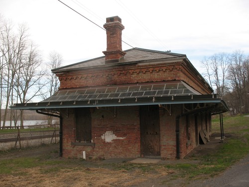
History of Stuyvesant Landing

The town of Stuyvesant is located in the northwest corner of Columbia County bounded by Rensselaer County on the North; the town of Kinderhook on the east; the town of Stockport on the south; and the Hudson River on the west. It was a part of Albany County until Columbia County was formed in 1786. Stuyvesant Landing, then known as Kinderhook Landing was part of the town of Kinderhook until April 21, 1823, when it became a town in its own right and was name Stuyvesant.
That Henry Hudson sailed up the River which bears his name in 1609 is a well established fact. He put ashore at Stuyvesant Landing on September 18th of that year, where he was greeted by friendly Indians with many children. The area became known as Kinderhook meaning "children's corner". This area was called Kinderhook even before any settlement was established there, as it appeared on Block's map made in 1614. The Indians in this area were Mahikans.
A map made in 1630 by Belroeck door I Vingboons shows both Nutinhoeck and Kinderhoeck on the River. In 1638 New Netherlands was opened to free immigration and unrestricted trade. In about 1640 permanent settlers began to appear in this area.
Major Abraham Staats, who had place on Stockpot Creek, sent 4,200 beaver skins to Amsterdam in 1657.
One of the first recorded land transactions was later known as the Powell patent. Permission was given in July 1664 by the Commissaries at Fort Orange (Albany) and confirmed by Gov. Stuyvesant for several people to purchase land. The Dutch surrendered to the English in September but the new governor confirmed the grant unto Thomas Poule (Powell), Headrick Abells and others to a certain parcel of land lying and being betwixt the Nutted and Kinder Hoeck near fort Albany. This grant was given March 29, 1665. This land included the present day village of Stuyvesant and extended to the Kinderhook Creek. Nutted Hoeck is easy to place as the present day Newton Hook. Kinder Hoeck spoken of at this time was a Hoeck on the river presently known as Stuyvesant Landing.
Franks Peiteers Clover's Saw Kill is a little stream two miles north of Stuyvesant Landing and contained a mill as early as 1665 and must have been one of the first, if not the first mill, in the country. The stream has been known by various names from Pittannoock, the Indian name to Frans Peters Clover's Saw Kill, to Light House Creek and finally Mill Creek.
The early history of the town would not be complete without mentioning the visit by two Labadist Brethren while looking for a place to settle with some of their religious sect. The importance of this event is that they left a written record of their visit to the Hudson River area in 1679. Their record tells of anchoring at Kinderhook Landing to take on some grain that a female trader wanted carried down the river. While loading was being done, the two brethren walked up a creek and visited a waterfalls where a man had a saw mill. Kinderhook at this time was an area along th Hudson River currently known as Stuyvesant Landing not the present day village of Kinderhook.
Semi-weekly post riders were established along the river as early as 1684. Most of the travel from New York to Albany was on the river.
Fur trade declined and in its place agriculture predominated. Great Britain restricted the colonies from manufacturing goods. They were to supply the mother county with raw materials and buy the finished products from Great Britain. Trade between Great Britain the West Indies and this area made the landowners prosperous. Overseas ships sailed up as far as Albany. By 1749, there were 47 sloops on the river. Stuyvesant had its share of sloop owners. Roads were crude and not much improved until after the Revolution. Post riders carried mail up and down the river shore until 1786, when the mail stage was established on the Old Post Road on the east side of the Hudson.
One of the first mills in the area was the saw mill already mentioned, run by Frans Pelters Clover. At Stuyvesant Falls there were grist and saw mills, with not much firm data as to the date but definitely in the 18th century as indicated on the map of 1743 to 1749 of the survey of Van Alen. A French map made by Bellin in 1744 labels the area "Moulin des Essars" meaning a mill built upon cleared ground. Other early mills were plaster mills, distilleries and foundries.
Brick making was established in the 18th Century using the fine clay deposits in the area.
The first census of Kinderhook in 1714 (and it is hard to know how much area this covered but it did include Stuyvesant Landing) showed a population of 193. By 1790 the census showed the town of Kinderhook at 4461.
When the town of Stuyvesant was formed, the name of Kinderhook Landing was changed to Stuyvesant Landing and Glencadia became Stuyvesant Falls. Medad Butler, a leader in the Landing and father of Benjamin F. Butler, had procured the essential authority to have the name changed in honor of Peter Stuyvesant.
During the French and Indian War and also the Revolution the town escaped serious trouble. It had a few people who were loyalist but the majority were patriots, some of whom fought for the cause of freedom. The area was noted for the wheat it produced and shipped during the revolution.
A post office was established at Kinderhook Landing in 1816 by the Federal Government. In 1826 there were two post offices; one brought mail three times a week by land rider the other had mail every day by steamboat.
This area along the Hudson was a haven for escaped slaves making their way North.
It is believed that Kinderhook Landing was used as a way station on the underground railroad.
The above text is used by permission of the Town of Stuyvesant, New York and was taken from "A Brief History of the Town of Stuyvesant" by Priscilla B. Frisbee, Town Historian, copyright 1976, all rights reserved, and published by the Town of Stuyvesant Bi-Centennial Committee. This publication is available at the Town of Stuyvesant Town Hall, Sunset Drive, Stuyvesant, NY 12173 (518) 758-6248.


